Login
EuropaOwners Recent Updates NortheastTexas
Advanced Search
View Slideshow (Fullscreen)

Recent Updates

1. IMG_8648 ... 89. NorthwestTe... 90. NortheastTe... 91. NorthwestTexas 92. NortheastTexas 93. IMG_6659post 94. IMG_6658post 95. IMG_6647post ... 121. IMG_3410post

Random Images

DSC00452

DSC00452

Date: 04/03/2010 Views: 5267

Fuel_System_21

Fuel_System_21

Date: 09/16/2007 Views: 4391

Starboard wing 119.

Starboard wing 119.

Date: 07/21/2009 Views: 5023

Newest Image

EAA SITE

EAA SITE

Date: 08/23/2023 Views: 705429

Most Viewed Image

EAA SITE

EAA SITE

Date: 08/23/2023 Views: 705429

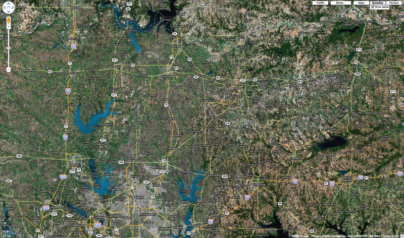
NortheastTexas

This is a Google Image/Map of northeastern Texas. It is about 120 NM (222 KM) across. It covers the area described in the 2009 09 25 flight. Denton is near the lower left corner.

Date: 09/27/2009
Size:
Full size: 1639x968
nextlast
first previous
NortheastTexas

Photo Properties

Orientation Normal (O deg) Resolution Unit Inch
X Resolution 72 dots per ResolutionUnit Y Resolution 72 dots per ResolutionUnit
nextlast
first previous
Powered by Gallery v2.3